Tools that make sailing safer, smarter, and way more fun.
When heading out to sea, the most important tools aren’t always physical. In our sailing routine, there are a few mobile apps that have earned their permanent spot on our home screen. Whether we’re cruising well known areas or exploring a new coastline, these apps save time, boost safety, and often prevent arguments over anchor spots or dinner bills.
Here are our go-to mobile apps for sailing:
1. Navionics Boating
🗺️ Navigation
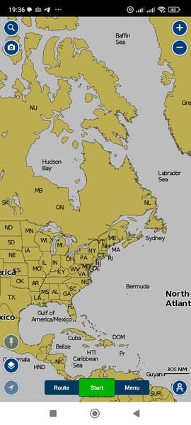
This is the core of my sailing setup. Navionics turns your phone or tablet into a powerful chartplotter. We use it for:
- Route planning
- Depth awareness
- Checking tides & currents
- Auto-routing based on boat specs
The sonar chart layer and crowd-sourced data are super helpful when navigating unfamiliar waters. Offline maps are a must when signal disappears offshore.
🧭 Available for: iOS, Android
💸 Paid, with a free trial
2. Navily
⚓ Harbor and Anchorage Guide
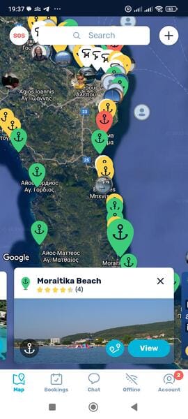
Navily is like TripAdvisor for sailors. It shows marinas and anchorages with real reviews from the community. You can:
- See how protected a spot is from wind & swell
- Check prices for berths
- Book marina stays
- Read comments from other captains
It’s my go-to when looking for a good overnight spot and making sure we’re not anchoring on rocks or in protected zones.
🧭 Available for: iOS, Android
💸 Free, with premium features
3. Windy
🌬️ Weather and Wind Forecasts
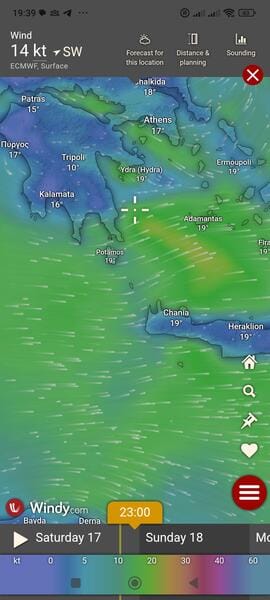
Windy is my weather crystal ball. The visual wind maps are addictive, and I often compare ECMWF and GFS models. You get:
- Wind, waves, pressure, rain, and thunderstorms
- Excellent forecast animations
- Global coverage
We usually check Windy multiple times a day. It's especially useful when planning passages or choosing anchorages with good wind protection.
🧭 Available for: iOS, Android, Web
💸 Free
4. Komoot
🥾 Outdoor & Hiking Maps
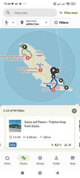
Once docked or anchored, We use Komoot to explore inland trails, viewpoints, or even nearby towns. It’s a brilliant hiking and cycling route planner with:
- Offline topographic maps
- Difficulty-based routes
- Voice navigation on trails
It’s a great way to stretch your legs and see the coast from another perspective.
🧭 Available for: iOS, Android, Web
💸 Free with optional region unlocks
Optional: Tricount
💶 Expense Splitting Made Simple
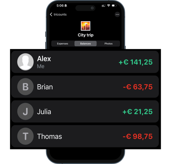
When sailing with friends, things can get messy with shared groceries, marina fees, diesel, and dinners. Tricount helps:
- Track who paid what
- See who owes who
- Settle evenly with minimal transfers
It keeps the mood light and avoids awkward “who owes what” convos at the end of a trip.
🧭 Available for: iOS, Android
💸 Free
Final Thoughts
We love analog sailing—paper charts, celestial navigation, knot tying—but in the modern world, having the right apps turns a good trip into a great one. These tools make it easier to plan, adapt, and enjoy every mile.
Exploring the world one tack at a time